Crystal Palace and Upper Norwood has an amazing rich and diverse heritage. On this interactive map (click here), you can explore Nationally listed assets (by Historic England) and Locally Listed (by each of the 5 boroughs) marked with Blue and Yellow Icons. Shown too are the many commemorative plaques (eg famous people or historic boundary markers) shown as small coloured dots. Also included are many of our conservation management areas too.

To access the map click here.
- Blue Pins are Nationally listed by Heritage England for Grade I, Grade II* and Grade II
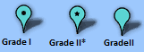
- Grade I buildings are of exceptional interest, only 2.5% of listed buildings are Grade I
- Grade II* buildings are particularly important buildings of more than special interest; 5.8% of listed buildings are Grade II*
- Grade II buildings are of special interest; 91.7% of all listed buildings are in this class and it is the most likely grade of listing.
- Yellow Pins: are ‘Locally Listed‘ (by one of the five Local Authorities that meet at Crystal Palace)

- Dots: are Blue Plaques, Green Plaques and other Plaques (shown in grey include boundary markers). Web links to their source listing/info pages. Sadly, plaques shown in black are lost or no longer visible to the public.
- Areas – are the local Conservation Areas in Crystal Palace. Also show are the multiple Local Boroughs areas (and their boundaries) that all meet at Crystal Palace.
Red Shield – are registered Asset of Community Value from the local authority.

LATEST UPDATES:
Pillar Boxes! – Crystal Palace is one of VERY few places in the country you can find one example of the historic royal cyphers all in one location! Rare and Nationally Listed pillar boxes are now shown on the map.
Arthur Francis – Pioneering scooter tuner and racer – Coopers Yard, Crystal Palace, SE19 1TN. Arthur Francis – Pioneering scooter tuner and racer lived here Lived here 1984-2021.
MARGARET LOCKWOOD 1916-1990 Actress lived here blue plaque erected 2018. 14 Highland Road, Upper Norwood, London, SE19 1DP
Please help, and make your suggestions for what’s missing! Have you spotted a boundary marker or plaque, or other listed feature not on the map? Please contact info@cpneighbours.org to add others listed/plaques heritage features onto the map (attaching a photo and location details). The area has many local heritage and ‘Friends of’ groups, and local reference libraries to help discover the area. More detailed information to be provided soon. e.g Norwood Society (click here). All the heritage mapping data is being created in standard format to allow sharing with other other groups/uses.
Any questions or suggestions? Contact cpneighbours on info@cpneighbours.org
